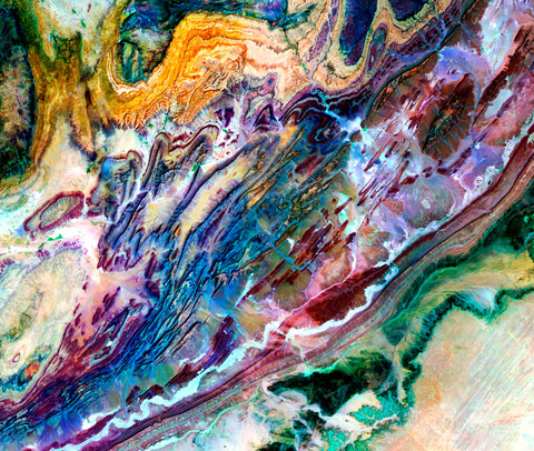
Tremendous forces come into play when two large tectonic plates collide.
This image of the Anti-Atlas mountains of Morocco shows some of the results of
the collision between the Africa and Eurasia plates that began about 80
million years ago. This image overlaps with
AntiAtlas1.
The numerous folded belts of sedimentary rocks attest to the strength of this collision.
The differing degrees of erosion of these rocks are due to differences in hardness of
the rocks. Compare this view with a
photograph
taken by astronauts aboard the Space Shuttle.
The area covered by this image is approximately 106x90 miles. A full-resolution crop
of the image file is available
here that shows the detail
present in the full image print.
|